The short answer: Yosemite is the granite masterpiece of the Sierra Nevada — a compact, world-famous valley walled by the largest granite monolith on Earth, laced with some of the tallest waterfalls in North America, and set inside nearly 1,200 square miles of high country. The entrance fee is about $35 per vehicle for seven days, and the single thing that trips up first-timers is the entrance reservation, which the park has required in some recent peak seasons and dropped in others (as of this writing, none was required for the 2026 season). Beyond that, the whole game is timing: come in spring for the roaring waterfalls, start at dawn, park once and ride the free valley shuttle, store your food in the bear lockers, and this park gives back far more than you came for.
Most national parks give you one big thing — a canyon, a geyser field, a single unforgettable rock. Yosemite gives you all of them at once: three-thousand-foot granite walls, waterfalls that fall from hanging valleys, giant sequoias older than Rome, and subalpine meadows above ten thousand feet. It is a compact valley so perfectly composed that it launched the idea of the national park itself, and yet the valley is only the front porch of a park that runs across the high Sierra.
It is also one of the easiest great parks to get slightly wrong. Its entrance-reservation rule changes from year to year, half its grandeur lives on two roads buried in snow for much of the year, its most iconic hike is a lottery, and its gentle-looking river has swept away the careless. None of that should scare you off; all of it should shape how you plan — which is what this guide is for. And because this is a perennial guide, reservation rules, fees, road-opening dates, and permit details all drift, so confirm specifics on nps.gov/yose and Recreation.gov before you go.
Want the whole plan in one place? This article distills The Ultimate Guide to Yosemite National Park by Leo Sotropa — when to go, how the reservations and permits really work, the best hikes at every level, where to stay, the scenic drives in order, and ready-made itineraries, every figure sourced. Honest about the crowds and the dangers, written like advice from a well-traveled friend.
What this guide covers
- Why Yosemite is worth it (and the honest cons)
- Fees, the entrance reservation, and the new nonresident surcharge
- When to go: seasons, waterfalls, and crowds
- Getting there and getting around
- The signature sights
- Hiking: the best trails at every level
- Scenic drives and the seasonal roads
- Where to stay, inside and out
- Wildlife, safety, and the water warning
- The human and natural story
- Itineraries at a glance
- Frequently asked questions
A quick disclaimer, in the book’s own spirit: this guide is independent and unofficial, and it is not affiliated with or endorsed by the National Park Service. Confirm current fees, reservation rules, road seasons, and permits on nps.gov/yose and Recreation.gov before you travel.
Why Yosemite is worth it (and the honest cons)
What sets Yosemite apart is the concentration. Other parks have granite, or waterfalls, or big trees, or high alpine country; Yosemite has all of them, with the history of the national park idea layered on top. The valley is only about seven miles long and less than a mile wide, yet the walls rise three thousand feet and more of sheer granite. The park covers about 759,620 acres — nearly 1,200 square miles — and climbs from around 2,000 feet in the foothills to 13,114 feet at Mount Lyell, stacking oak woodlands, forest, giant sequoia groves, and subalpine granite one atop another. Yosemite Falls alone drops about 2,425 feet in three tiers, among the tallest in North America, and all of it draws roughly 3.9 to 4.3 million visits a year, most funneling into that one small valley.
Now the honest part, because you deserve better than brochure copy:
- The valley gets crowded. On summer days the floor fills up and traffic backs up at the pullouts; by late morning it can feel more like a busy parking lot than a wilderness.
- Half the park is seasonal. Glacier Point Road and Tioga Road — where the grand overlook and the high country live — are closed by snow much of the year, often into late spring.
- The marquee experiences carry homework. The entrance reservation comes and goes, Half Dome requires a lottery permit, and the best campgrounds and lodges sell out months to a year ahead.
- The waterfalls are seasonal. Spring is the roar; by late summer Yosemite Falls often dwindles to a trickle or dries up entirely, which surprises visitors every year.
- The dangers are real. The Merced above the falls has killed strong swimmers, wet granite is lethally slick, and bear-proof food storage is mandatory everywhere.
Yosemite is a near-perfect fit for first-time awe, spring waterfalls, hiking and climbing, giant sequoias, and photography — a less natural one if you crave solitude on the valley floor on a July afternoon. Come with the right expectations and a little preparation, and there is simply no place like it.
Fees, the entrance reservation, and the new nonresident surcharge
Yosemite is one of the most rewarding parks to visit and one of the fiddliest to plan. Here is the whole fee-and-access picture in plain terms.
The basic entrance fee, as of this writing, is about $35 per private vehicle (good for seven days), $30 per motorcycle, or $20 per person on foot or bike; children under 16 enter free. A Yosemite annual pass runs about $70, and the America the Beautiful interagency pass (about $80) covers entrance here and at every federal park [VERIFY at nps.gov].
The item that trips up more Yosemite trips than any other is the entrance reservation. In some recent peak seasons the park has required a timed day-use reservation just to drive in; in others it has not. For the 2026 season, the park announced none was required, including during the February firefall — but do not carry that forward as gospel, because the system comes and goes. Check nps.gov/yose for your dates [VERIFY every year]. When it has been in effect, holders of in-park lodging, camping, or a Half Dome permit have typically been allowed in without one — a reason those in-park beds are worth chasing.
There is also a new rule: as of January 1, 2026, Yosemite is one of the parks where non-U.S. residents age 16 and older pay an additional $100 per person on top of the regular fee. It is waived for holders of an eligible America the Beautiful pass or the Non-Resident Annual Pass (about $250), and U.S. residents and children under 16 do not pay it [VERIFY]. The full breakdown — Half Dome lottery, camping, and lodging — lives in the Yosemite reservations and permits explainer.
When to go: seasons, waterfalls, and crowds
There is no single Yosemite — there are four, one for each season, and they barely resemble one another. The trick is not to chase a mythical perfect week but to decide which Yosemite you want to meet.
| Season | What it delivers | Watch out for |
|---|---|---|
| Spring (Apr–Jun) | Peak waterfalls — Yosemite Falls, Bridalveil, and the Mist Trail at full roar; green valley, blooming dogwoods | Glacier Point Road and Tioga Road often still closed by snow; cold, swift, dangerous rivers |
| Summer (Jul–Aug) | The whole park open, the high country reachable, Tuolumne Meadows at its best, river floating | Busiest and hottest in the valley; falls fading; lots full by mid-morning |
| Fall (Sep–Oct) | Golden light, thinner crowds, pleasant temperatures, easier parking | Waterfalls low or dry (Yosemite Falls typically gone); high roads close with the first big storm |
| Winter (Nov–Mar) | Snow-hushed valley, the February firefall, ice skating at Curry Village, Badger Pass ski area | Tioga Road and Glacier Point Road closed all season; tire chains may be required |
The sweet spot most seasoned visitors chase is late May into June, when the falls are still running hard and the high-country roads have just cracked open. For fewer people and golden light, September is lovely; for snowy drama and the firefall, come in February. One truth the calendar will not tell you: Yosemite runs on the winter that preceded your visit — a heavy snow year keeps the high roads closed later and the falls roaring longer, a light year opens the roads sooner and quiets the falls earlier. Whatever month you pick, visit the valley on a weekday, at dawn. The month-by-month version is in the itinerary and reservations guide.
Getting there and getting around
The closest major airport is Fresno Yosemite International (FAT), roughly 2 to 2.5 hours from the South Entrance; the Bay Area airports — San Francisco (SFO) and Oakland (OAK) — plus Sacramento (SMF) sit about 3.5 to 4 hours west; and Reno-Tahoe (RNO) works only when Tioga Road is open. Rent a car, and budget more time than the app suggests for the mountain road at the end.
Which of the five entrances you use shapes your whole trip. Arch Rock (Highway 140) is the lowest and most weather-reliable, past El Portal and Mariposa — the winter default. Big Oak Flat (Highway 120 West) comes through Groveland, best for Bay Area arrivals and Hetch Hetchy. South (Highway 41) runs through Oakhurst and Fish Camp, nearest the sequoias and Wawona. Tioga Pass (Highway 120 East) from Lee Vining and Mono Lake is open only when Tioga Road is. And the Hetch Hetchy Entrance is a day-use destination in itself.
Once you arrive, internalize the most important sentence in any Yosemite plan: in the valley, park once and ride the shuttle. The free Yosemite Valley shuttle loops the eastern valley year-round, and waiting for it beats circling a full lot; two seasonal shuttles serve the Mariposa Grove and Tuolumne Meadows [VERIFY schedules]. A few realities that catch people out: there is no gas station in Yosemite Valley (fuel up in a gateway town), cell service is patchy the moment you leave the valley, and the regions are far apart — so plan one region per day.
Planning a real trip? The Ultimate Guide to Yosemite National Park by Leo Sotropa turns all of this into a day-by-day plan — the reservations and permits step by step, the trails with distances and honest hazards, where to stay, and itineraries for a day, a weekend, or five days.
The signature sights
If you only read one section, make it this one. Several string together on a single valley day, reachable on the free shuttle; others sit up the seasonal roads or an hour south and deserve their own block of time.
- Tunnel View. If you do one viewpoint, do this one. On Highway 41 at the east end of the Wawona Tunnel, it frames the classic composition — El Capitan left, Bridalveil Fall right, Half Dome anchoring the distance — in a single glance from the parking area. Best at sunset, and secretly best of all in drifting storm cloud.
- El Capitan. The largest granite monolith in the world and the birthplace of modern big-wall climbing — a sheer 3,000-foot wall. From El Capitan Meadow, bring binoculars to pick out climbers as tiny specks living for days on the face.
- Half Dome. The park’s emblem, that great sheared-off granite helmet above the valley’s east end. Superb to admire from the valley floor, Sentinel Bridge, and Glacier Point. Climbing it is a very long day hike of roughly 14 to 16 miles finishing with the famous cables — permit required, won by lottery.
- Yosemite Falls. About 2,425 feet in three tiers, a genuine roar in spring. The easiest encounter is the paved Lower Yosemite Fall loop, about a mile to the misty base on the shuttle; by late summer the fall often vanishes entirely.
- Bridalveil Fall. The graceful ribbon at the valley’s mouth — the one on the right at Tunnel View — reached by a short paved path of about half a mile. Because it pours from a hanging valley it seems to drift rather than fall, and it holds water later than most.
- Glacier Point. The great drive-up overlook, about 3,200 feet directly above the valley floor with Half Dome and the high country below. Reached by the seasonal Glacier Point Road; time it for sunset, and stop at Washburn Point on the way.
- Mariposa Grove. Yosemite’s cathedral of giant sequoias near the South Entrance, home to the venerable Grizzly Giant and the walk-through California Tunnel Tree. Reached by a seasonal shuttle from the South Entrance Welcome Plaza.
- Tuolumne Meadows, Tenaya Lake, and Olmsted Point. A completely different Yosemite along the high country of Tioga Road — polished granite, an alpine lake ringed by domes, a subalpine meadow at about 8,600 feet, and a back-of-the-mountain view of Half Dome. Seasonal, and always calmer than the valley.
Two of the park’s greatest “sights” are events, not places: the roaring spring waterfalls (and the giant sequoias), and the February firefall at Horsetail Fall — that brief mid-to-late-February window when, if the water is flowing and the sky is clear, sunset lights the fall so it glows like lava off the flank of El Capitan. For the full rundown beyond hiking, see things to do in Yosemite Valley.
Hiking: the best trails at every level
The valley floor is glorious, but the real Yosemite — the one that rearranges your sense of scale — lives a mile or two up the trail. A few habits separate a great day from a frustrating one: start at dawn to beat the parking crush and the heat, store all food in the trailhead bear lockers, carry plenty of water, and respect the water and the weather. And day hiking anywhere except Half Dome needs no permit — you just lace up and go.
| Trail | Distance (RT) | Effort | Payoff |
|---|---|---|---|
| Lower Yosemite Fall | ~1.0 mi loop | Easy, paved | Thundering base of the falls (spring) |
| Bridalveil Fall | ~0.5 mi | Easy, paved | Graceful fall that flows much of the year |
| Mirror Lake | ~2.0 mi (5-mi loop) | Easy | Reflection of Half Dome (spring) |
| Mariposa Grove Big Trees Loop | ~0.3–2 mi | Easy | Giant sequoias, the Grizzly Giant |
| Mist Trail to Vernal Fall | ~2.4 mi (~1,000 ft) | Moderate | Granite staircase in the spray; Nevada Fall extends it to ~5.4–7 mi |
| Sentinel Dome | ~2.2 mi | Moderate | 360° summit (Glacier Point Road, seasonal) |
| Cathedral Lakes | ~7.0 mi | Moderate | Classic High Sierra lake (Tuolumne, seasonal) |
| Upper Yosemite Fall | ~7.2 mi (~2,700 ft) | Strenuous | Top of the falls and the valley rim |
| Half Dome | ~14–16 mi (~4,800 ft) | Strenuous | The cables to the summit (permit required) |
| Clouds Rest | ~14 mi | Strenuous | Summit higher than Half Dome, arguably the best view in the park |
Distances marked “about” are commonly cited figures; confirm current details at nps.gov. The park’s signature hike is the Mist Trail, a granite staircase alongside Vernal and Nevada Falls that soaks you in spring — steep, wet, and unforgettable, with drop-offs that demand you stay behind every railing. For the full difficulty-graded guide, including Half Dome and quieter alternatives, see Half Dome, the Mist Trail, and the best hikes in Yosemite.
Scenic drives and the seasonal roads
Not every great Yosemite moment requires a trail; some of the most staggering views arrive through a windshield. The catch is seasonality: the valley and its loop roads are open year-round, but Glacier Point Road and Tioga Road close in winter and typically reopen only in late spring. As a representative example, in the 2026 season Glacier Point Road opened around May 9 and Tioga Road around May 15, but these dates swing widely with the snowpack and must be checked every year on nps.gov [VERIFY annually].
When they are open, they roughly double your options. Glacier Point Road climbs to the great overlook and the Sentinel Dome and Taft Point trailheads. Tioga Road, the great alpine drive, threads Olmsted Point (with its high-country view back at Half Dome), Tenaya Lake, and Tuolumne Meadows — give it the better part of a day, and fuel up first. Down in the valley, the loop roads pass El Capitan Meadow and the falls, and in summer the flat, paved bike paths are often the fastest way around. For the full high-country drive plan, see the Glacier Point and Tioga Road guide.
Where to stay, inside and out
Where you sleep does more to shape your trip than almost any other decision. Wake up inside the valley and you step out under the walls before the day-trippers have finished their coffee in Fresno; wake up two hours away and you spend a chunk of every day driving in and out. The catch is that the best in-park beds are the hardest to get — every lodging property is run by the concessioner, and prime dates can book close to a year ahead.
Inside the park, options run from grand to rustic. The Ahwahnee is the 1920s grand hotel of stone and timber, a bucket-list splurge. Yosemite Valley Lodge, near the base of Yosemite Falls, is the practical sweet spot — unfussy rooms in an unbeatable spot on the shuttle loop. Curry Village offers tent cabins at a friendlier price (ice rink in winter, pool in summer), and Housekeeping Camp gives you rustic units along the Merced. South in Wawona, the Victorian Wawona Hotel trades bustle for genteel calm near the sequoias, and White Wolf and Tuolumne Meadows Lodge offer simple high-country cabins in the short summer season. Camping is wonderful and fiercely competitive: the valley’s Upper, Lower, and North Pines can vanish within minutes of release on Recreation.gov, and historic walk-in Camp 4, the spiritual home of American rock climbing, runs by reservation or lottery.
If the valley is full — and it often is — base in a gateway town. On the reliable Highway 140 corridor, El Portal sits closest to the gate and Mariposa is a Gold Rush town with the fullest services. Groveland (Highway 120 West) is the northern door for Hetch Hetchy; Oakhurst and Fish Camp (Highway 41) are the southern gateway to the big trees; and Lee Vining and Mammoth Lakes anchor the east side, useful only when Tioga Road is open. For a first visit, stay inside the valley if you can, and if not, El Portal or Mariposa keeps you close with the least weather risk. More on choosing a base is in the scenic-drives guide and the itinerary guide.
Wildlife, safety, and the water warning
Here is the thing people get wrong: they arrive braced for bears and get blindsided by water. Both matter — but read the water part twice.
Bears and food storage. Yosemite is black bear country — no grizzlies — and the problem is never a wild bear but one that has learned to associate people with food. That is why bear-proof food storage is mandatory everywhere: use the metal lockers, and never leave food, coolers, or anything scented in your car, day or night. A fed bear becomes a bold bear, a bold bear becomes a dangerous one, and a dangerous bear often ends up dead — so storing your granola bar is an act of conservation. Keep your distance from all wildlife, including the mule deer, which injure more people here than bears do.
The water. Water kills more people in Yosemite than anything else. Wet granite — on the Mist Trail especially — is lethally slick, and the Merced above the falls is the deadliest place in the park: the current moves faster and colder than it looks and has swept people over the edge again and again. The rule is simple and absolute: never swim or wade above a waterfall, stay behind every railing, and keep children within arm’s reach of any moving water, coldest and swiftest of all in spring runoff. Beyond that: on the high domes, be off exposed summits by early afternoon to dodge thunderstorms and never go up the Half Dome cables in wet weather; carry plenty of water in the heat; pace yourself for altitude; and heed all rockfall closures. When rescue is needed it is the storied Yosemite Search and Rescue (YOSAR) team that comes — and every rule you keep is a rescue they do not have to risk their lives to perform.
The human and natural story
Once you understand how this valley came to be, you never look at it the same way again. The granite formed as the Sierra Nevada batholith cooled roughly 100 million years ago, then uplift and erosion brought it into the light; only much later did Ice Age glaciers grind the river’s V-shaped canyon into the broad U you see now, leaving hanging valleys over which Bridalveil and Yosemite Falls pour. Half Dome owes its rounded back not to a single dramatic slice but to exfoliation — granite relieved of its burden, shedding curved shells like an onion. If you hear a boom on a clear day, that is the park still being built.
The human story is older still and must be told honestly. The valley — Ahwahnee in their language — is the ancestral home of the Ahwahneechee and Southern Sierra Miwuk and other Native peoples, who lived here for millennia before an armed state militia, the Mariposa Battalion, entered in 1851 during the Gold Rush. That was dispossession, not discovery, and the connection is a living one, reflected in the reconstructed Indian Village behind the Yosemite Museum and in deepening tribal partnerships. Protection took hold early: in 1864, mid-Civil War, Abraham Lincoln signed the Yosemite Grant, setting aside the valley and the Mariposa Grove — the first time the federal government protected land this way. John Muir became its champion, Yosemite gained national park status on October 1, 1890, and it became a UNESCO World Heritage Site in 1984. Not every chapter is triumphant: the fight over damming Hetch Hetchy ended with the O’Shaughnessy Dam (completed 1923) and a reservoir, a loss that galvanized the conservation movement even in defeat.
Itineraries at a glance
Yosemite is not one place but five, and they are far apart, so good plans stay in one region per day and lean hard on early starts. One day belongs entirely in Yosemite Valley — Tunnel View at dawn, the Mist Trail, Lower Yosemite Fall and Cook’s Meadow, El Capitan Meadow, and a sunset. Two days add a second region: the giant sequoias in the south, or the high country along Tioga Road. Five days add a big valley hike, a Glacier Point Road day, a Tioga Road day, and a gentle finish at the Mariposa Grove or quiet Hetch Hetchy. Full hour-by-hour plans are in the Yosemite itinerary guide, and the family version is in the Yosemite with kids guide.
Ready to build your own plan? The Ultimate Guide to Yosemite National Park by Leo Sotropa gives you the seasons, the reservations-and-permits playbook, the trails with distances and hazards, the scenic drives, where to stay, and ready-made itineraries — honest about the crowds and the dangers, rich with the wildlife and history that give Yosemite its soul.
Frequently asked questions
Do I need a reservation to enter Yosemite?
It depends on the year. Yosemite has required a timed day-use entrance reservation in some peak seasons and dropped it in others; for 2026 the park announced none was required, including during the February firefall. Because it changes annually, check nps.gov/yose for your dates. You always need the entrance fee or a valid pass regardless. See the reservations and permits explainer.
How much does it cost to get into Yosemite?
About $35 per private vehicle for seven days (about $30 per motorcycle, $20 per person on foot or bike), children under 16 free. The America the Beautiful pass (about $80) covers it. As of January 1, 2026, non-U.S. residents 16 and older also pay a $100-per-person surcharge unless they hold an eligible pass [VERIFY].
When should I go to Yosemite?
For roaring waterfalls plus the opening high country, aim for late May into June. For fewer crowds and golden light, September is hard to beat. For snowy drama and the firefall, come in February. Whatever month you pick, visit the valley on a weekday, at dawn.
Do I need a permit to hike Half Dome?
Yes, whenever the cables are up (roughly late May to mid-October), and rangers check. It is awarded by lottery on Recreation.gov — a preseason lottery in March or a daily lottery two days ahead, with roughly 300 day-hiker permits per day. Day hiking anywhere else needs no permit.
When are Glacier Point Road and Tioga Road open?
Roughly late spring through fall, snow permitting; both close in winter. As a representative example, in 2026 Glacier Point Road opened around May 9 and Tioga Road around May 15, but the dates swing every year with the snowpack, so check current status at nps.gov [VERIFY].
Do I really have to store my food?
Yes. Bear-proof food storage is mandatory everywhere — use the metal lockers and never leave food or scented items in your car. It protects both you and the bears, because a bear that learns to raid cars often ends up dead.
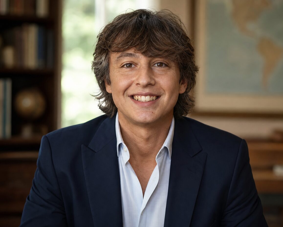
Meet Leo: The Heartbeat Behind ‘A Country A Month’
Journeying through the pages of A Country A Month, you might often feel the rhythm of a storyteller’s heartbeat, pulsating through each line, each image, and each adventure shared. That heartbeat belongs to none other than our remarkable website editor, Leo.
With a lens in one hand and a pen in the other, Leo seamlessly marries his passions for photography and writing. His eye captures moments that words can barely describe, yet his eloquence brings those images to life, transcending borders and connecting us all through shared stories. An avid traveler, every country he’s visited has added another chapter to his expansive tale, and through our platform, he generously shares these chapters with us.